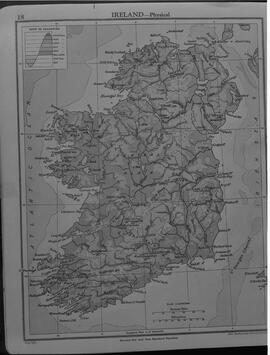
Black and white negative of the map of Ireland. Envelope notes the initials E.O'C.
Shannon DevelopmentMap of Ireland. London: G. W. Bacon & Co. Ltd. With an advertisement for Flanagan’s Footwear, Enniskillen, county Fermanagh.
Daly Family of Limerick CityBlack and white negative of a map of the Shannon Industrial Estate. Negative missing.
Shannon DevelopmentBlack and white negative copy of the map of the housing and factory site for development. Negative missing.
Shannon DevelopmentPhotocopy of the street map of Faversham.
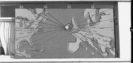
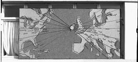
O'Toole, Michael (1938-2000), journalist, author and bibliophileBlack and white negative of a map of Europe showing the position of Shannon Airport, made out of metal with a tweed fabric background. Envelope notes the initials T.J.C.
Shannon DevelopmentBlack and white negative of a map of Europe showing the position of Shannon Airport, made out of metal with a tweed fabric background. Envelope notes the initials T.J.C.
Shannon DevelopmentBlack and white Ordnance Survey map sheet no. XVIII/7 of Carricksaggart and surrounding area in county Waterford on a scale of 25.344 inches to 1 statute mile.
Looney, Timothy (Tim) (1914-1990), local historianSecond edition black and white Ordnance Survey map sheet no. 81 of Ballylooby, county Tipperary and surrounding area to the north on a scale of 6 inches to 1 statue mile.
Looney, Timothy (Tim) (1914-1990), local historianFirst edition black and white Ordnance Survey map sheet no. 55 of Ballingarry village, county Tipperary and surrounding areas on a scale of 6 inches to 1 statute mile. A small number of fields have been outlined in red and marked ‘Bridget St. John’.
Looney, Timothy (Tim) (1914-1990), local historian

