IE 2135 P50/1/1/701
·
Pièce
·
c. December 1958-January 1959
Fait partie de The Shannon Development Collection
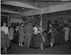
Black and white negative of the camera and watch duty free counters at Shannon Airport.
Sans titre