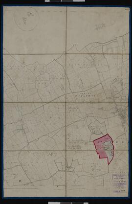
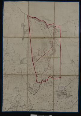
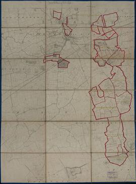
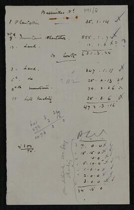
6 Treffer anzeigen

Archivische Beschreibung
Valuation book
IE 2135 P91/1 · Objekt · 1900-1901
Teil von Valuation Records of the Estate of C. J. Coote

Bound soft-back valuation book containing a valuation of Captain Charles James Coote’s estates in counties Limerick and Cork. The valuation is in two parts, commencing with townlands in county Limerick and followed by townlands in county Cork. For each townland, the following information is recorded in tabular form: map reference number; names of occupiers; names of immediate lessors; description of tenement; area in acres, roods and perches; rateable annual valuation of lands, buildings and railways, fisheries, tolls, half-rents etc. in pounds, shillings and pence; total valuation in pounds, shillings and pence; and observations. The information recorded dates to 1900 and contains amendments in red ink to reflect the situation in 1901. Pagination, with an alphabetical index of townlands at the start of the book.

Ohne Titel
Part of an Ordnance Survey map for county Cork
IE 2135 P91/5 · Objekt · 1900-1901
Teil von Valuation Records of the Estate of C. J. Coote

Part of Sheet 2 of the black and white first edition six-inch Ordnance Survey map for county Cork, on which the boundaries of the townland of Ballyhubbo have been marked out in a thick red line as part of the estate of Captain Charles James Coote. A thin red line marks the separation of the townland into two holdings. The holdings are individually numbered to correspond with the map reference numbers in the valuation book (P91/1). The map is supported by linen backing and bears two stamps of the General Valuation Office in Dublin with the dates 20 July 1900 and 4 April 1901, respectively.

Ohne Titel
Valuation Records of the Estate of C. J. Coote
IE 2135 P91 · Fonds · 1900-1901

This small collection contains a valuation book of the estate of Captain Charles James Coote in counties Limerick and Cork and a box of associated maps.

Ohne Titel
IE 2135 P91/3 · Objekt · 1900
Teil von Valuation Records of the Estate of C. J. Coote

Part of Sheet 47 of the black and white first edition six-inch Ordnance Survey map for county Limerick, on which the townlands or parts of the townlands of Abbeyfarm, Ardkilmartin, Ardpatrick, Ballygillane, Ballynahown, Ballynamoloogh, Baunmore, Bawntard North, Bawntard South, Flemingstown, Millmount, Milltown, Mountcoote, Portauns, Riversfield and Steales have been marked out in thick red lines as part of the estate of Captain Charles James Coote. Within each townland, individual holdings are marked out in thin red lines and numbered, the numbers corresponding with the map reference numbers in the valuation book (P91/1). The map is supported by linen backing and bears the stamp of the General Valuation Office in Dublin with the date 3 July 1900.

Ohne Titel
Composite of Ordnance Survey maps for county Cork
IE 2135 P91/4 · Objekt · 1900
Teil von Valuation Records of the Estate of C. J. Coote

Composite of fragments of Sheets 8, 9, 17 and 18 of the black and white first edition six-inch Ordnance Survey maps for county Cork, on which the boundaries of the townlands of Ballintlea North and Ballintlea South are marked out in thick red lines. Within each townland, individual holdings are marked out in thin red lines and numbered, the numbers corresponding with the map reference numbers in the valuation book (P91/1). The map is supported by linen backing and bears the stamp of the General Valuation Office in Dublin with the date 20 July 1900.

Ohne Titel